
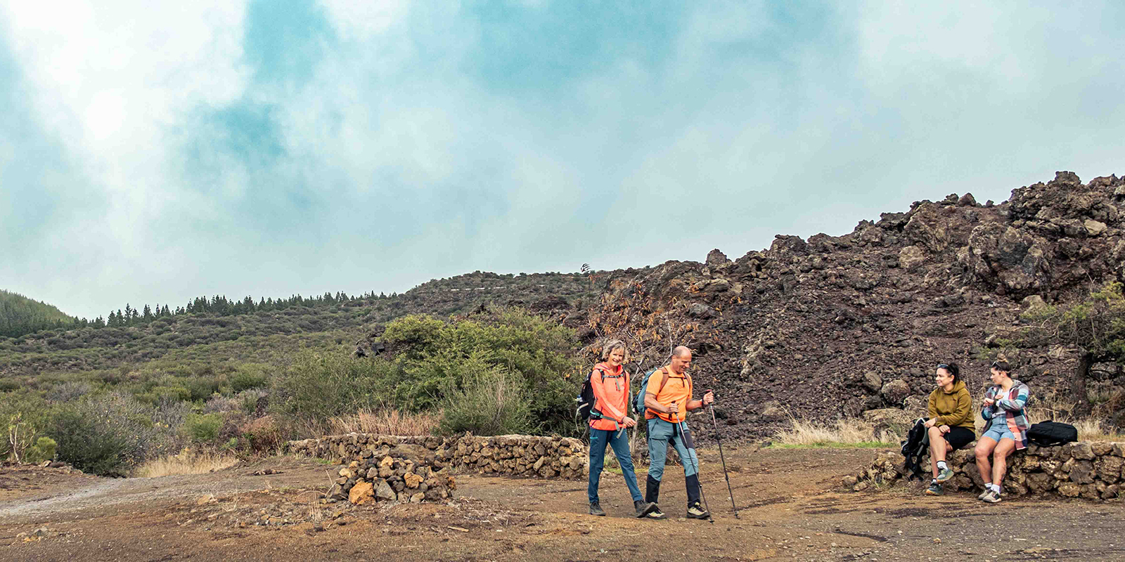
Hiking
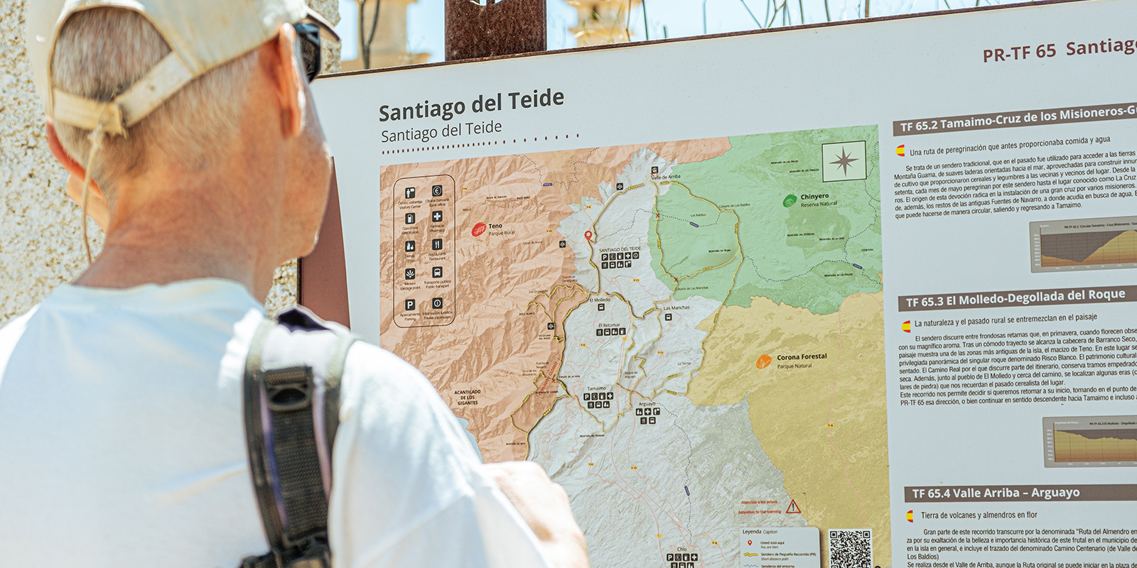
The municipality of Santiago del Teide has a network of trails covering almost 60 kilometres, and given its geographical location, it acts as a link between the north and south of Tenerife.
The municipality of Santiago del Teide has a network of trails covering almost 60 kilometres, and given its geographical location, it acts as a link between the north and south of Tenerife.
The PR TF-65 trail is the main axis of this network, with its variants and links connecting all the towns in the municipality via old roads that have been properly restored. There is the opportunity to explore spectacular and varied landscapes, from the coast to the recent badlands of the Chinyero Volcano, passing through the dizzying ravines of the Teno Massif. And, of course, discover our villages, visit our centres and museums, and enjoy the cuisine and tourist accommodation.
As a complement to the PR TF-65, there are other trails such as the PR TF-43.3 Santiago del Teide-Montaña Chinyero or the SL-201 Chío-Arguayo, all of which together will provide us with the unforgettable experience of hiking in a privileged natural environment.
Ecotur Route.
PR – TF 65
Santiago del Teide – Puerto Santiago
Distance: 19.8 km
Time: 7h 20 min
This trail is considered a single route, with different branches and links, running from the coast of Santiago del Teide to its summit. It allows you to visit the main towns in this municipality in the south-west of the island of Tenerife, with part of it running along the old Camino Real, formerly used by the local population to exchange fish for potatoes, almonds, and figs, among other essential products.
The benchmark on the coast is Puerto Santiago, one of Tenerife’s most attractive tourist centres, closely linked to the Cliffs of Los Gigantes, where sports and activities related to the sea and its natural resources abound. At the other end of the spectrum, following the Camino Real, is Santiago del Teide, the municipal capital.
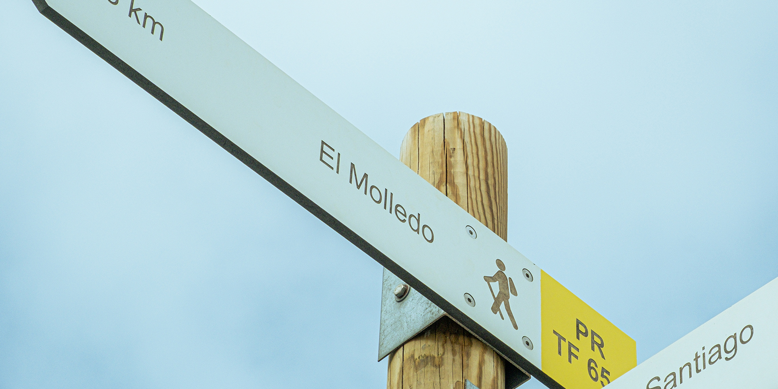
Of particular note is the Casa del Patio, a stately Canarian residence built between 1665 and 1668, an architectural legacy which, with its wine presses, threshing floors, and granaries, clearly defines the character of the estate that governed the town of Santiago del Teide. Currently, a rural hotel is located on these premises. The route reaches its highest point in the Upper Valley, at an altitude of 1,015 metres, surrounded by vineyards. The municipality’s first chapel was built here in 1550. El Molledo, Las Manchas, Arguayo, and Tamaimo are other villages we can pass through using any of the different routes on this itinerary, which also takes us to the gates of the Teno Rural Park.
Easy Routes
PR – TF 65.3
El Molledo – Degollada del Roque
Distancie: 2.1 km
Time: 55 min
Nature and the rural past blend in the landscape.
Nature and the rural past blend in the landscape.
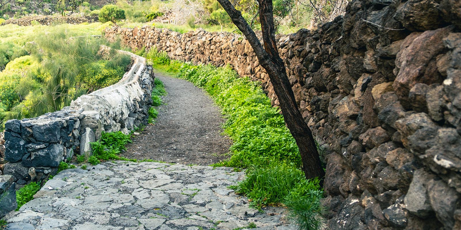
The trail runs through leafy broom bushes, which, in spring, when they bloom, treat walkers to their magnificent aroma. After a comfortable journey, you reach the head of Barranco Seco, where the rugged landscape reveals one of the oldest areas of the island, the Teno massif. This spot offers a privileged panoramic view of the unique rock formation known as Risco Blanco. Cultural heritage is also represented. The Camino Real, along which part of the route runs, still has cobbled sections and dry stone walls. In addition, next to the village of El Molledo and close to the road, there are some threshing floors (circular stone constructions) that remind us of the area’s cereal-growing past.
This route allows us to decide whether we want to return to the start, taking that direction at the junction with the PR-TF 65, or continue downhill towards Tamaimo and even Puerto Santiago.
PR – TF 65.5
El Molledo – Las Manchas
Distancie: 1.9 km
Time: 55 min

Paths of landscape and devotion.
Paths of landscape and devotion.
This route connects El Molledo, a small village located near the Teno Rural Park, with Las Manchas, located about 2 kilometres from the town centre of Santiago del Teide, at a maximum altitude of 975 metres.
The route allows us to admire breathtaking views of the Valle de Santiago, just as its neighbours once did when they exchanged their farm produce or held celebrations and festivities, such as the commemoration of the eruption of the Chinyero volcano every November, a popular neighbourhood gathering where the image of Santa Ana de Tamaimo is carried together with the Virgin of Pilar and Santo Domingo de Guzmán from the village of Las Manchas to the area known as El Calvario, where the inhabitants of that time, fearing they would be swept away by the lava, carried the image some 8 kilometres to the foot of the volcano’s lava flows, which inexplicably stopped in their path and did not advance any further.
The itinerary allows us to choose an alternative route (Link 1) and descend along it to reach the village of Arguayo.
PR – TF 43.3
Chinyero Circular Route
Distancie: 6.44 km
Time: 2h 30 min
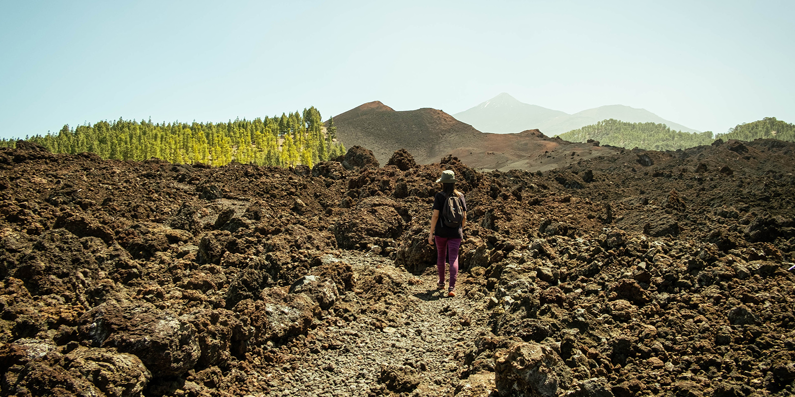
Ash, lava, and forest surrounding Tenerife’s last volcano.
Ash, lava, and forest surrounding Tenerife´s las volcano.
This easy circular route circles the cone of the Chinyero volcano, whose eruption in 1909 was the last recorded on the island of Tenerife. The route begins at kilometre 15 of the TF-38 road, on a road closed to traffic, where you can start walking.
The trail, which is well signposted, passes through sections of pine forest, fields of solidified lava, known as malpaíses, and extensive areas covered in volcanic ash, where vegetation is gradually making its way through.
Along the route, you can observe geological features of great interest, as well as an environment undergoing natural regeneration, notable for its Canarian pines, many of which bear the marks of past fires. Its proximity to the Chinyero cone allows for a clear view, although climbing to its summit is prohibited as it is a Special Nature Reserve.
This circular route allows you to enjoy one of the most unique landscapes in the municipality without any significant elevation changes, and can be done independently or as a connection to other more demanding routes.
Mid Routes.
PR – TF 65.1
El Molledo-Risco Blanco
Distancie: 3.6 km
Time: 1h 50 min
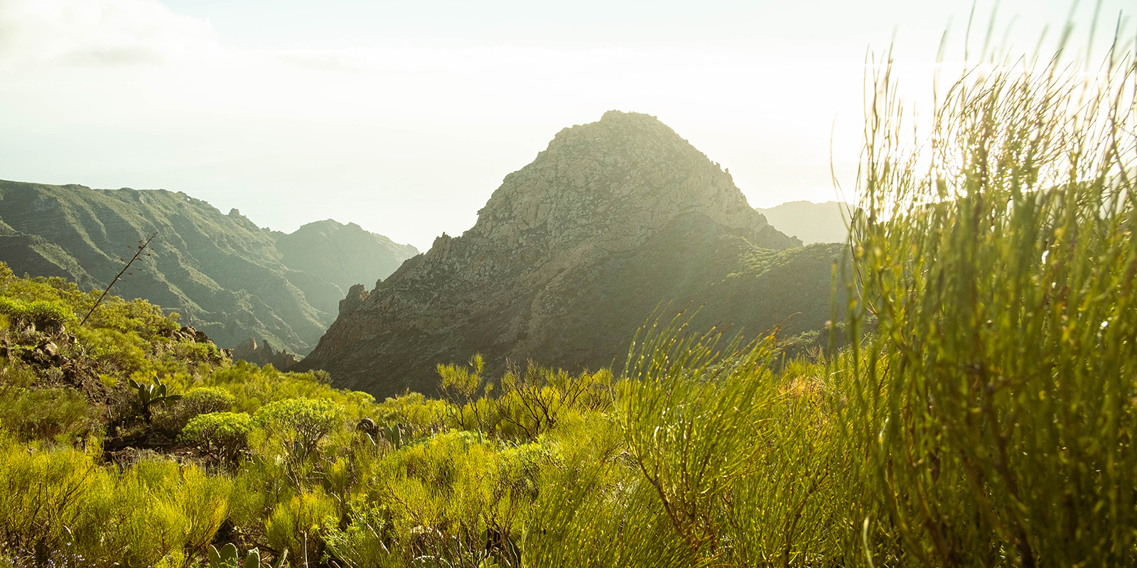
A traditional path leading to the base of Risco Blanco.
Caminos de paisaje y fervor.
From El Molledo, the trail, which in some sections still retains part of the old cobblestone pavement, climbs gently up the slopes of Montaña Jiñiga. Pass by the old Teneguera Fountain, which is still frequented by locals today to collect its precious water. Next to the current water jet, an old wash house and several troughs that served as drinking troughs for livestock remain standing.
Further along the road, you come to the hamlet of Los Quemados, a traditional pastoral settlement where cheese has been made by hand until almost the present day. At this point on the route, you can enjoy extraordinary views of the Santiago del Teide valley and the ancient Teno massif. The trail then winds down to the base of Risco Blanco, a unique geological feature that stands out for its peculiar shape and whitish tones.
From there, we can retrace our steps or take the route that connects us to Degollada del Roque, recommended only if you have some experience, and return to El Molledo using the PR-TF 65.3, or continue until we connect with the PR-TF 65, from where we can return to El Molledo or descend towards Tamaimo, and even Puerto Santiago.
PR – TF 65.2
Tamaimo-Cruz de los Misioneros-Guama-Tamaimo
Distancie: 4.4 km
Time: 2h 40 min
*Temporarily Closed
A pilgrimage route that once provided food and water.
Una ruta de peregrinación que antes proporcionaba comida y agua.
This is a traditional trail that was once used to access the farmland on Guama Mountain, with its gentle slopes facing the sea, which were used to build countless terraces for growing cereals and legumes for the residents.
Since the 1970s, every May, pilgrims walk along this path to the place known as La Cruz de los Misioneros (The Missionaries’ Cross). The origin of this devotion lies in the installation of a large cross by several missionaries. The path also conceals, in its final stretch, the remains of the old Fuentes de Navarro springs, where people used to go in search of water. It is a circular route, starting and ending in Tamaimo.
Difficult Routes.
PR – TF 65
Santiago del Teide – Puerto Santiago
Distancie: 7.87 km
Time: 2h 50 min
From the coast to the summit, through almond trees and volcanoes.
From the coast to the summit, through almond trees and volcanoes.
This trail runs from the coast of Santiago del Teide to its summit and allows you to visit the main towns in this municipality in the south-west of the island of Tenerife. Part of it runs along what is known as the old Camino Real, formerly used by the local population to travel to exchange fish for potatoes, almonds, and figs, among other essential products.
The benchmark on the coast is Puerto Santiago, one of Tenerife’s most attractive tourist centres, closely linked to the Cliffs of Los Gigantes, where sports and activities related to the sea and its natural resources abound. At the other end, following the Camino Real, is Santiago del Teide, the municipal capital. Of particular note is the Casa del Patio, a stately Canarian residence built between 1665 and 1668, an architectural legacy which, with its wine presses, threshing floors, and granaries, clearly defines the character of the estate that governed the town of Santiago del Teide. Currently, a rural hotel is located on these premises.
The route reaches its highest point in Valle de Arriba, at an altitude of 1,015 metres, surrounded by vineyards. The municipality’s first chapel was built here in 1550.
El Molledo, Las Manchas, Arguayo, and Tamaimo are other villages we can pass through using one of the different routes on this itinerary, which also takes us to the edge of the Teno Rural Park.
PR – TF 65.4
Valle Arriba – Arguayo
Distancia: 7,50 km
Duración: 3H 40 min
Tierra de volcanes y almendros en flor.
Tierra de volcanes y almendros en flor.
Gran parte de este recorrido transcurre por la denominada “Ruta del Almendro en Flor”, que se caracteriza por su exaltación de la belleza e importancia histórica de este frutal en el municipio de Santiago del Teide y en la isla en general, e incluye el trazado del denominado Camino Centenario (de Valle de Arriba al Calvario de Los Baldíos).
Se realiza desde el Valle de Arriba, aunque la ruta original se puede iniciar en la plaza de la iglesia del casco de Santiago del Teide coincidiendo con el trazado del PR-TF 43.3, y acaba en Arguayo.
Además de transitar por una zona de importante valor paisajístico, especialmente en el mes de febrero, momento en el cual la floración de los almendros está en todo su esplendor, durante su recorrido podrán descubrir retazos del pasado de este municipio: desde el Calvario de Los Baldíos, donde “los rezos y rogativas al Cristo del Valle hicieron que parase la lava” del volcán Chinyero; atravesará sus coladas, que nos recuerdan el pasado (y presente) eruptivo de nuestras islas; caminará por un espacio protegido con la categoría de Reserva Natural Especial; transitará por una tierra de pinos y escobones, donde aún quedan vestigios de los usos que los antiguos hicieron de ellos; y se concluirá Arguayo, pueblo de gran actividad agrícola, donde la tradición alfarera está aún muy viva.
Puede realizar un recorrido alternativo más corto (Enlace 3), tomando el desvío hacia Las Manchas a la altura de la Montaña Bilma. Igualmente, en el tramo final podrá elegir si lo realiza por el recorrido tradicional o por la zona conocida como Las Tierras (Enlace 2), que le permitirá caminar entre las terrazas de cultivo.
Ethical Tourism
Enjoy it responsibly and respectfully
- Always check the difficulty of each route before setting off and calculate the estimated time carefully.
- Do not go out alone, and inform someone of your route.
- Wear appropriate footwear, bring sufficient water, and protect yourself from the sun.
- Stay on the marked trails. Leaving the path can damage the environment and put you in danger.
- Do not light fires or use appliances that could cause fires. The risk is high in forested areas.
- Do not remove stones, plants, or other natural elements.
- Respect the local wildlife. Avoid loud noises and do not feed the animals.
- If you are going to take photographs, do so without compromising your safety or damaging the environment.
- Keep the route clean. Do not leave any rubbish, packaging, or cigarette butts behind.
- Remember that you are in a protected natural area. Taking care of it is also part of the experience.